
Photorealistic 3D Tiles: The Future of 3D Design and Visualization
Explore the integration of Google’s Photorealistic 3D Tiles in ArcGIS: visualize realistic urban contexts in BIM workflows, enhance the spatial analysis of your projects
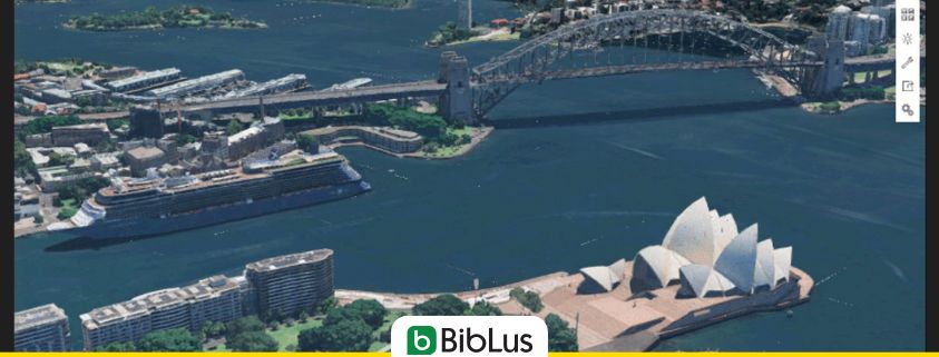
In recent years, three-dimensional territorial representations has made great leaps forward, radically transforming the way we design, analyze, and manage built environments and urban areas. One of the most significant innovations in this field is the introduction of Photorealistic 3D Tiles, a technology that combines the realism of photographic images with the power of geospatial data. Today, thanks to the collaboration between Google and Esri, access to this information becomes even more integrated, opening new perspectives for architects, engineers, and urban planners.
This evolution fits perfectly into the growing use of geospatial digital twin platforms, true integrated environments for managing digital twins of the territory that combine GIS data and BIM models to offer a complete, realistic, and dynamic view of the built environment.
Contents
- What are Photorealistic 3D Tiles and why are they revolutionizing the industry?
- Photorealistic 3D Tiles in ArcGIS: Google and Esri Revolutionize 3D Mapping
- The Role of Photorealistic 3D Tiles in BIM (Building Information Modeling)
- The Future of Photorealistic 3D Tiles in Construction and Urban Planning
What are Photorealistic 3D Tiles and why are they revolutionizing the industry?
Photorealistic 3D Tiles represent one of the most significant innovations in recent years in the field of geographic and architectural visualization. They are high-definition 3D tiles that reproduce buildings, landscapes, and urban infrastructures in an extremely realistic manner, offering an unprecedented immersive experience. Thanks to advanced modeling and photogrammetry techniques, these tiles allow for the visualization of over 2,500 cities in 49 countries with a precision and detail never seen before.
This technology is rapidly changing the way professionals and companies operate, transforming 3D from a simple representation tool into a true decision-making engine in the fields of architecture, engineering, construction, and urban planning.
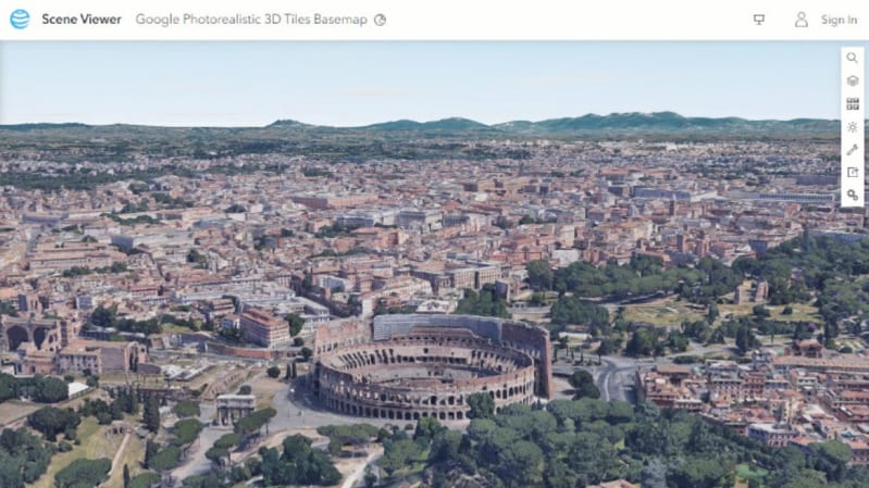
Photorealistic 3D Tiles – Rome
Applications in Architecture and Construction
In the world of architecture and construction, photorealistic 3D tiles offer a fundamental competitive advantage. Architects and designers can insert their BIM models within faithfully reconstructed urban contexts, facilitating the understanding of the visual and environmental impact of projects.
Moreover, construction companies and clients can benefit from a clear and shareable representation of the progress of work, improving communication among all stakeholders involved. These 3D maps allow for the simulation of interventions, assessment of constraints and critical issues, and execution of accurate analyses of the surrounding territory.
For those looking to concretely integrate GIS data with BIM models and obtain a complete view of the project within its real context, usBIM.geotwin represents the ideal solution. The platform allows for the connection of territorial information and BIM data in a unique digital environment, facilitating advanced analyses, territory management, and informed design.
The Advantages Over Traditional Models
Compared to traditional 3D models, photorealistic 3D tiles offer a series of key advantages:
- superior realism: thanks to the use of aerial photographs and advanced detection technologies, the level of visual detail is extremely accurate;
- immediate accessibility: there is no need to create custom models or go through lengthy manual modeling phases;
- time savings: users can quickly integrate the 3D context into their projects without having to write code or possess advanced technical skills;
- constant updates: data is periodically updated, ensuring a consistently current representation of the urban context.
Photorealistic 3D Tiles in ArcGIS: Google and Esri Revolutionize 3D Mapping
A news story making waves in the industry is the announcement that Esri will soon offer a new 3D basemap based on Google’s photorealistic tiles. This collaboration marks a turning point: access to photorealistic 3D tiles will be simplified within ArcGIS, making 3D mapping more accessible than ever.
How ArcGIS Will Leverage Google’s Photorealistic 3D Tiles
ArcGIS users will be able to integrate 3D views of over 2,500 cities directly into their projects with just a few clicks. The new basemap 3D will serve as a layer for visual and geographic reference on which to overlay other spatial data. This will eliminate the need for complex steps or coding skills to take advantage of this high-quality data.
Thanks to this integration, ArcGIS will become an even more powerful platform for those working in the AEC sectors, public administration and infrastructure management, providing a deeper understanding of spatial relationships and supporting faster, more informed decisions.
The Role of Photorealistic 3D Tiles in BIM (Building Information Modeling)
The integration of photorealistic 3D tiles with BIM tools represents a true revolution. Inserting three-dimensional informative models into a real and updated context, allows for a more accurate compatibility checks between the project and the surrounding environment. This leads to improved collaborative design and coordination among multidisciplinary teams.
Furthermore, the ability to navigate and analyze the BIM model directly within a photorealistic urban environment facilitates the presentation phase to clients and approving entities, reducing misunderstandings and accelerating approvals.
The Future of Photorealistic 3D Tiles in Construction and Urban Planning
With the advent of these new 3D maps integrated into ArcGIS, the future of photorealistic 3D tiles looks bright. Increasing use is expected not only in the fields of construction and architecture but also in sectors such as:
- sustainable urban planning: detailed analyses of environmental and urban impact;
- smart cities: intelligent management of infrastructure thanks to updated and shared 3D data;
- public safety and emergency management: support for evacuation plans and risk analysis;
- real estate commerce and marketing: realistic and engaging presentations of new developments.
With Google and Esri committed to making this technology increasingly accessible, photorealistic 3D tiles are set to become the new standard for anyone working with territorial and project data.
For further insights, also read:
- GIS Technology (geographic information system), what it is and what it is for
- GIS and environmental sciences: analysis, applications, and sustainability practices
- GIS in urban and regional planning: uses and examples


