
Reality Capture in Construction: Revolutionizing Project Visualization and Management
From digital surveys to smart project management. Exploring the transformative power of Reality Capture technologies in modern construction

Technology is revolutionizing construction: Reality Capture is now one of the most powerful tools for designing, building, and managing more efficiently.
Too often, survey errors and fragmented communications compromise the accuracy of design and coordination among teams. Delays on site, discrepancies between the project and the built reality, and difficulties in managing complex assets are symptoms of a process that needs to evolve. Thanks to laser scanners, drones, and photogrammetry, it is possible to acquire highly detailed and up-to-date 3D representations of the physical environment, integrating them directly into the BIM workflow. This technology drastically reduces the margin of error and enhances decision-making capacity throughout the entire lifecycle of the project.
To fully leverage the advantages of Reality Capture, it is essential to integrate it into an advanced BIM Management System. This platform allows you to collaborate in real-time, visualize georeferenced 3D models, and centralize information management in a simple and accessible way from any device.
In this article, we will analyze how this technology is revolutionizing the sector, helping to reduce design errors, improve planning, and optimize construction times and costs.
Contents
- Reality Capture: definition and fundamental principles
- Main technologies and tools: laser scanning, photogrammetry, drones, and mobile devices
- Practical Applications in Construction
- Benefits of Adopting Reality Capture in Construction
- Reality Capture in Construction: Impact on Design and Sustainable Construction
- FAQ – Reality Capture in Construction
Reality Capture: definition and fundamental principles
The term Reality Capture refers to the set of technologies, tools, and digital methodologies that allow for detecting and digitally reproducing, in three dimensions, the built or natural physical environment. Its main function is to acquire geometric, spatial, and visual data of the real environment through advanced sensors, returning extremely detailed and accurate digital models in the form of point clouds, 3D meshes, or georeferenced orthophotos. These models form the basis for analysis, simulations, design, and management of interventions in the construction and infrastructure sectors.
The fundamental principle of Reality Capture is to transform physical space into a dynamic, updatable, and interoperable digital data. The acquired data is generally processed in specialized software that transforms them into navigable three-dimensional models, which can be integrated into BIM (Building Information Modeling), GIS (Geographic Information System), or CAD (Computer-Aided Design) environments. In this way, the built environment is reproduced in the form of a digital twin, a “digital twin” that constitutes a faithful virtual replica of its physical counterpart, useful not only for initial design but also for operational management, maintenance, historical documentation, and predictive analysis.
A key aspect of Reality Capture is also temporality: it is possible to carry out periodic surveys to monitor the progress of work, compare real conditions with project models, and identify any deviations or discrepancies. This makes Reality Capture an essential tool for quality control, coordination among involved parties, and the prevention of costly errors on site.
Main technologies and tools: laser scanning, photogrammetry, drones, and mobile devices
At the core of Reality Capture is a combination of innovative technologies that allow for extremely accurate and comprehensive digital surveys, which have become indispensable in numerous application contexts, including architectural surveys. In specialized fields such as the restoration of historic buildings, the integrated design of new constructions, or the monitoring of complex infrastructures, having a faithful digital representation of the physical reality is the starting point to ensure consistency, reliability, and control in the subsequent phases of the project.
The acquisition of this data occurs through sensors and technologies capable of detecting geometries, textures, and spatial characteristics of the built environment, transforming the real world into navigable and measurable three-dimensional models. This process not only significantly reduces the margins of error compared to traditional manual surveys but also allows for obtaining detailed and multidimensional technical documentation, useful for design, simulation, verification, maintenance, or time comparison activities.
Whether intervening on existing building stock, designing new works, or monitoring the progress of a construction site, the richness and reliability of the information acquired through Reality Capture technologies represent a decisive operational advantage. The quality of the data directly influences design and management choices, helping to optimize time, costs, and resources used.
Let’s analyze in detail the main tools that make all this possible.
3D Laser Scanning
3D laser scanning is based on the emission of laser pulses by a scanner towards the surfaces of the objects to be surveyed. The time taken by the beam to return to the sensor allows for extremely precise calculation of the distance between the instrument and every point in the surrounding environment. By repeating this process millions of times per second, the system generates a three-dimensional point cloud that represents the real geometry of the surveyed space.
3D scanners can be:
- terrestrial, used for stationary surveys from fixed positions;
- airborne, mounted on drones for scanning large areas or structures inaccessible from the ground.
The most advanced versions also integrate mobile mapping capabilities, allowing data acquisition in motion, for example, for road or infrastructure mapping.
This technology stands out for its extremely high density and precision of data, with tolerances that can drop below a millimeter under controlled conditions. Laser scanning is particularly suitable for documenting complex environments, irregular surfaces, historic buildings, and structures with extremely elaborate architectural details, for which the quality of the survey is crucial.
Digital Photogrammetry
Digital photogrammetry allows for the reconstruction of three-dimensional models starting from two-dimensional photographs taken from different angles. Through sophisticated processing algorithms, the software identifies common points between images (keypoints) and calculates their spatial position, thus generating a three-dimensional point cloud. This point cloud is then used to build a 3D mesh, which is a digital surface made up of polygons that accurately represent the shape of the surveyed objects. Additionally, it is possible to create high-resolution orthophotos, which are geometrically correct and georeferenced photographic images that provide a detailed visual representation of the surveyed surface.
Image acquisition can occur with:
- drones, which allow for covering large surfaces with extreme speed and flexibility;
- terrestrial cameras, ideal for detailed surveys of facades, interiors, or complex objects;
- mobile systems, mounted on vehicles or backpacks, to document extensive spaces dynamically.
Compared to laser scanning, photogrammetry has the advantage of combining geometric information and visual images, returning textured three-dimensional models useful for aesthetic evaluations, visual communication, and monitoring of the actual state. Moreover, it is often preferred in contexts where greater cost-effectiveness is required or where laser tools cannot be used.
While generally having lower precision than LiDAR, photogrammetry represents an extremely effective technology, especially when integrated with other survey systems, as it allows for combining operational flexibility, speed of acquisition, and visual fidelity.
Drones and Mobile Devices
The use of drones and mobile devices represents an operational extension of Reality Capture technologies, as they allow for collecting information even in complex or hard-to-reach environments.
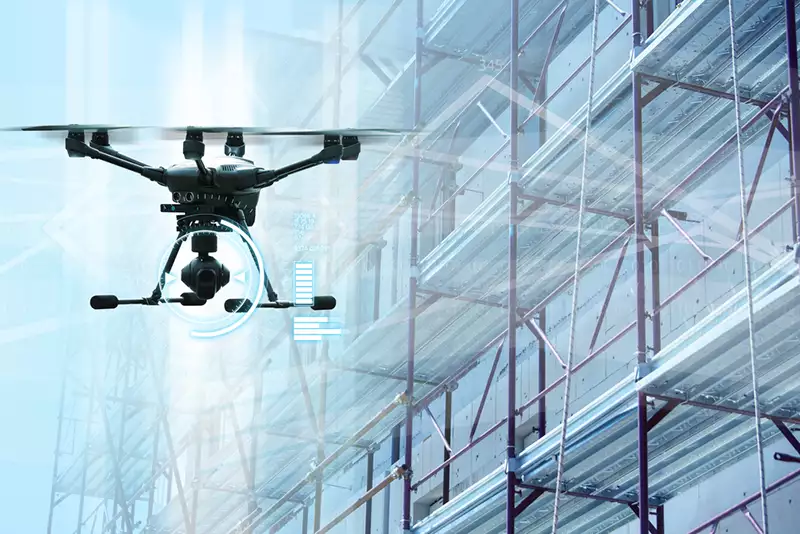
Drones, in particular, are essential for surveying large areas, roofs, facades, or hazardous zones that are difficult to reach with ground tools. Equipped with photogrammetric or airborne LiDAR sensors, they can generate orthophotos, DSM (Digital Surface Model), point clouds, and high-resolution 3D meshes with unmatched speed and coverage compared to traditional methods. Additionally, thanks to the programming of automated flights, it is possible to standardize acquisitions and repeat them over time for comparative analyses and evolutionary monitoring.
I mobile devices, on the other hand, include portable tools such as tablets and smartphones equipped with LiDAR sensors or RGB cameras, as well as SLAM systems mounted on backpacks or vehicles. These tools are ideal for quick surveys in interiors, galleries, plants, or dense urban environments, where flexibility, speed, and mobility are essential. In many cases, the collected data can be synchronized in real-time with cloud platforms or processing software, thus accelerating the workflow.
Processing and Modeling Software
3D data acquisition technologies, such as laser scanners, drones, and mobile devices, would have no real utility without software tools capable of processing, modeling, and interpreting the collected information. Processing and modeling software represent, in fact, the central phase of the Reality Capture workflow, thanks to their ability to transform large amounts of data, often consisting of millions or billions of points, into structured, coherent, and usable digital models.
The acquired data is generally imported in the form of point clouds, from which it is possible to generate mesh models, surfaces, georeferenced orthophotos, and three-dimensional views. Specialized software allows filtering, aligning, and optimizing the data, correcting any imperfections and improving the readability of the survey. In many cases, these tools integrate functions for automatic registration, semantic classification, texturing, and metric analysis, which simplify and speed up the modeling process.
Downstream of processing, the data can be exported and managed in more advanced design and management environments, such as BIM software, GIS (Geographic Information System), or CAD (Computer-Aided Design). Integration with these environments allows enriching geometric models with additional information (materials, schedules, costs, planned maintenance, etc.), creating true digital twins, that is, intelligent digital replicas of the physical environment.
Practical Applications in Construction
Reality Capture technologies are revolutionizing the construction industry, introducing new standards of accuracy, efficiency, and control throughout the entire lifecycle of the work, from design to post-construction management. The ability to acquire accurate and up-to-date three-dimensional models of the physical environment allows supporting every phase with objective, measurable data that can be easily integrated into existing digital workflows.
Reality Capture finds application in many operational activities:
- survey of the existing state pre-intervention;
- verification of design tolerances during the execution phase;
- monitoring of work progress;
- production of as-built documentation.
By integrating the collected data with BIM environments and project management tools, it is possible not only to achieve technical advantages but also to improve planning, logistics, and communication among all stakeholders involved. Furthermore, the generated digital models can also be used in the post-construction phase for predictive maintenance activities, asset management, and periodic control of structural conditions.
Let’s take a closer look at the main applications.
As-Built Documentation and Construction Verification
One of the most strategic applications of Reality Capture in construction is the production of as-built documentation, that is, the accurate digital representation of the work as it has actually been carried out. Unlike design drawings, as-built models reflect the real conditions during or at the end of construction.
Technologies such as laser scanning, photogrammetry, and SLAM systems allow for the rapid acquisition of high-density point clouds, accurately documenting the built geometries. The collected data can be compared with the original BIM or CAD models to identify discrepancies, variances, or execution errors, ensuring precise quality control and compliance with technical and regulatory specifications.
As-built models are also useful after construction, for example, for testing, building management, maintenance, or updating technical archives. In contexts that require high traceability, such as public works or strategic buildings, they provide essential support for transparency and reporting.

BIM model with as-built documentation
Integration with BIM and digital twin
The integration between Reality Capture and the BIM environment represents one of the most significant evolutions in the digitalization of construction. The data acquired through laser scanning, photogrammetry, or SLAM can be imported into BIM software, enriching the informational models with geometric representations faithful to the built reality.
This synergy improves design accuracy, facilitates checks and coordination, and makes the management of ongoing changes more efficient. Point clouds and 3D meshes are used to create or update parametric models, facilitating the comparison between the current state and the project, the validation of construction tolerances, and the detection of interferences.
The approach is particularly effective in interventions on existing buildings, as the survey provides updated and reliable data, reducing margins of error during the execution phase.
The processing of data in the BIM environment also allows for the creation of digital twins: dynamic digital models that reproduce the work over time. These digital twins enable the monitoring of performance, planning of maintenance, simulating future scenarios, and centrally managing all technical information throughout the life cycle of the building or infrastructure.

Digital Twin of a building: data and information
Monitoring of Work Progress and Site Management
Reality Capture technologies provide advanced tools for monitoring work progress and managing the construction site more effectively. Periodic high-definition surveys, using laser scanners or photogrammetry, allow for accurately and continuously documenting the current state of the work, dynamically updating the digital model.
This enables quick comparisons between the built structure and the project, identifying discrepancies, deviations, or delays. The overlap between surveys and design models allows for anticipating critical issues before they turn into operational problems or extra costs.
The availability of objective and timely data also improves site planning, optimizing operational phases, logistics, and resources. Furthermore, the constant documentation of progress ensures complete traceability, useful for both contractual purposes and reporting to the client as well as coordination among teams. The systematic adoption of reality capture makes site management more transparent, responsive, and controlled, reducing the risk of errors, disputes, and delays.
Improving Safety and Reducing Risks
Reality Capture technologies significantly contribute to improving safety on construction sites, providing effective tools to reduce workers’ exposure to risk and prevent accidents. One of the main advantages is the ability to conduct remote surveys in hazardous or hard-to-reach areas — such as confined spaces, elevated zones, or degraded facades — avoiding direct exposure of operators.
The three-dimensional analysis of point clouds allows for early detection of elevations, unstable surfaces, critical structural elements, or interferences between operations. The early identification of these issues enables corrective measures to be taken before activities commence, enhancing operational safety.
Updated and reliable models also allow for safer planning: routes, machinery positioning, and material logistics can be defined based on real data, avoiding rough estimates. The ability to perform many checks remotely reduces the need for site visits in risky areas, further limiting personnel exposure.
Finally, the generated 3D models serve as a valuable support for training and briefings on site, offering realistic representations of the site to illustrate critical scenarios, explain operational procedures, and raise awareness among personnel about the behaviors to adopt for safe working.

Practical applications of Reality Capture in construction
Benefits of Adopting Reality Capture in Construction
The integration of Reality Capture technologies in construction and infrastructure processes marks a significant evolution in how spatial data is captured, managed, and utilized. Obtaining an accurate 3D digital representation of the built environment brings concrete benefits both operationally and strategically. Here are the main advantages of systematic adoption:
- Data reliability and completeness: High-density digital surveys provide detailed information on geometries, volumes, and conditions of the work, eliminating uncertainties typical of partial surveys and supporting more accurate assessments from the early stages;
- Project and site optimization: Georeferenced digital models offer a shared reference for all disciplines, reducing interferences, changes during construction, and promoting adherence to time and cost;
- Better multidisciplinary collaboration: The availability of an updatable and centralized model facilitates coordination among designers, contractors, site management, and clients, even for non-technical figures;
- Evolving post-construction management: The acquired data feeds as-built models and digital twins, essential tools for maintenance, monitoring, and updating the built environment over time;
- Quality control and continuous monitoring: Periodic surveys allow for accurate comparison between project and reality, promptly detecting deviations and improving quality control on site;
- Efficiency and sustainability: Accurate knowledge of the current state allows for more rational planning, reducing waste and environmental impact through more efficient use of materials, resources, and time.
Reality Capture in Construction: Impact on Design and Sustainable Construction
The adoption of Reality Capture is a key element in guiding the sector toward more sustainable and conscious models. It is not just about tools for reading the built environment but foundational technologies for precise design and intelligent management of the built environment.
A detailed three-dimensional representation of the current state helps avoid unnecessary interventions, promote solutions that enhance the existing structure, and reduce resource consumption, waste, and emissions.
In the design phase, updated models allow for calibrating geometries and materials to the real environmental, structural, and economic constraints, fostering the circular economy through the reuse of existing elements.
During execution, continuous monitoring ensures consistency between design and construction, reducing errors, rework, and inefficiencies, while improving safety and operational efficiency.
In the management phase, digital documentation supports targeted and preventive maintenance, extending the useful life of the building.
A further step forward in the 3D workflow has been made with the LGSx format, developed by Leica Geosystems. This innovative format encompasses in a single highly compressed file point clouds, panoramic images, photographs, videos, metadata, geotags, annotations, and 3D models.
In the digitization process of the AEC sector, being able to rely on work environments capable of centrally managing heterogeneous and complex formats is becoming increasingly crucial. In this scenario, usBIM stands out as an advanced BIM Management System, capable of supporting the LGSx format, alongside BIM models, IFC files, technical documentation, and much more.
Thanks to its cloud architecture, usBIM allows for easy visualization, organization, and integration of 3D survey data and project assets in a single shared environment. The centralized management of 3D models, technical data, and updated documentation ensures accurate planning, effective control, and conscious maintenance, improving the overall quality of the project and fostering lasting results. Rely on this solution for a technological ally capable of transforming complex data into effective decisions, enhancing the overall quality of the project and ensuring lasting results over time.
FAQ – Reality Capture in Construction
What is Reality Capture in construction?
Reality Capture is the set of digital technologies and methodologies that allow for the detection of physical environments (built or natural) and reproduce them in a three-dimensional digital form. In construction, it allows for the creation of accurate and updatable models useful in all phases of the life cycle of a project.
Which technologies are used for Reality Capture?
The main technologies are 3D laser scanning, digital photogrammetry, and SLAM systems, employed through terrestrial instruments, drones, or mobile devices. These tools allow for the acquisition of point clouds, panoramic images, 3D meshes, and other relevant data.
What are the practical applications of Reality Capture on site?
The main applications include:
- Survey of the pre-intervention status;
- Verification of tolerances during construction;
- Monitoring of work progress;
- Creation of as-built documentation;
- Site management and support for post-construction maintenance.
How does Reality Capture improve safety on site?
It allows for remote surveys in hazardous areas, reducing personnel exposure. 3D models also help identify critical issues before the start of work and plan pathways and logistics more safely.
What advantages does integration with BIM offer?
Integration with BIM allows for updating or creating precise parametric models, facilitating coordination among teams, validating tolerances, and creating digital twins. This improves design quality and makes operational and maintenance management more efficient.
How does Reality Capture promote sustainability?
It helps avoid unnecessary interventions, optimize materials and resources, reduce waste and emissions, supporting more efficient and circular construction. Additionally, updated models assist in predictive maintenance, extending the useful life of buildings.


